
This page provides a QBASIC program that
generates DXF files that draw the base plate and
moveable horizon window for a planisphere of given latitude. The
base plate is produced in three parts (the RA and DEC scale, the
star map, and the constellation lines) to allow flexibility in
labelling and style of presentation.
If you need a 'ready made' planisphere template try the page by M. S. Pettersen at Otterbein College.
A planisphere consists of two discs of plastic with a common central pivot allowing them to rotate. The base plate has a star map and lines of right ascension and declination, and there is a scale of months and days drawn around the edge with March 21st corresponding to RA = 0 hours. The moveable horizon plate has a window showing the visible horizon for the latitude at which the planisphere is plotted and a scale of hours of time around the circumference, arranged so that 0h is in the same direction as the North horizon. In use, if we want to know what stars are visible at 22h on November 26th, we rotate the horizon plate so the 22h mark co-incides with the Nov 26th date, and the horizon window shows the stars visible.
DXF
Files will import into many drawing and painting programs to
allow for printing and re-sizing. I use CorelDRAW version 6,
Paint Shop Pro and AutoSketch 2.2 and all will import the files
fine.
The method used here is a direct implementation of a suggestion in Brian Tung's page about the Planisphere, and you should read that page if you are not familiar with the planisphere. The program here is based around the following ideas:
QBASIC hack below will produce a workable
unlabelled planisphere provided that you can import the files
into a program that allows you to super-impose the two base plate
files. I used CorelDRAW, and imported each DXF file into a
separate layer. By using the 'layer manager' I could then
superimpose the star map and grid, and print each plate
separately. I could also apply a 'fill' to the open circles
representing the stars!
The QBASIC program below produces four DXF
files, three associated with the base plate and one that plots the
moveable horizon window. The horizon window is the part of the
planisphere that depends on the latitude - just change the value
of phi to match your latitude (above 37.5 degrees).
You can download the program and the data file with star
coordinates and visual magnitudes using the links below. Both
files should be copied to the same directory. Load
planastr.bas into QBASIC and run the
file. You should see four DXF files appear in the
directory.
QBASIC program PLANASTR.BAS to make the 4
unlabelled DXF files
YALE.DAT) - the data in this file is used to
plot the stars on the star map.
CONLINES.DAT) - the data in this file is used to
plot the lines making the constellation figures on the
conline.dxf file. The current file was pinched from the
conline.csv file that forms part of John Walker's excellent Home
Planet star chart program.
Below are examples of the three output files, rendered as GIF files by Paint Shop Pro:
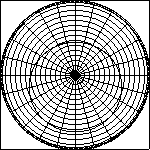
GRID.DXF: The RA and DEC
grid with a scale of days in the year, part of the base
plate.
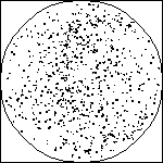
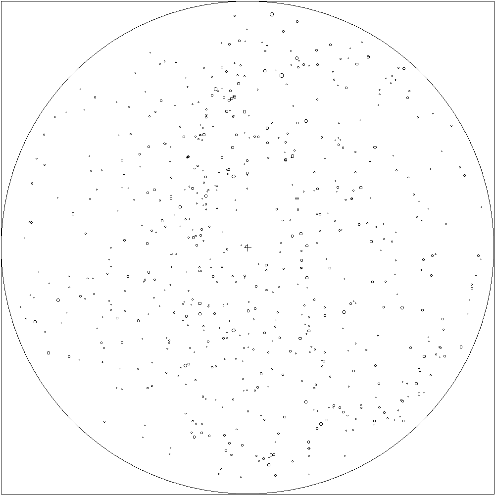
STARS.DXF: A plot of some
stars in the Northern hemisphere, a second part of the base
plate.
CONLINE.DXF: A the
constellation figures for the Northern hemisphere, a second
part of the base plate.
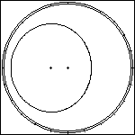
HORIZON.DXF: The horizon window [ samples: latitude
52.5 | latitude 37.5 ] with a scale of hours -
this is the bit that turns around the NCP. You need to print this
one onto acetate.
A number of people have generously contributed code or links by e-mail.
QBASIC
program.
Thanks to these people for their encouragement, feedback and enthusiasm!
I checked the shape of the horizon window by printing out a copy the same size as my Phillips 5 inch planisphere for 51.5 degrees north and comparing the shape of the horizon window with a tracing of the window from the Phillips planisphere. The two matched in shape to a satisfyingly good degree. I then made a working planisphere using two printouts with the horizon window cut out with a scalpel and the days and hours scales added by hand. The resulting star view matches that in the commercial planisphere well.
Following a suggestion from Robert Lane, it turns out that the horizon window and ecliptic curves may well be ellipses - and this will make plotting them much easier (and the DXF files smaller). More on this soon - but I checked the horizon window by folding the window along the N-S axis and along the E-W axis with promising results. I then superimposed an ellipse in CorelDRAW and, by trial and error, managed to produce a curve that matched the horizon curve very closely...
Another reality check is to remember that the North horizon has a declination equal to 90 - latitude, and the Southern horizon has a declination equal to -(90 - latitude), so you can check two points on the horizon directly.
[ Root ]
Last Modified 2nd December 2000
Keith Burnett